Slots Available
Melting Glaciers, Failing Dams:
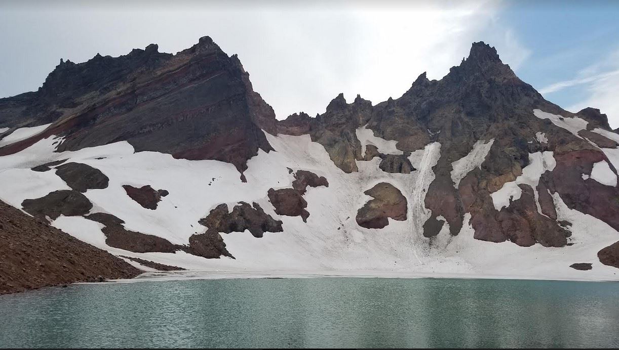
The 1966 Debris Flow from No Name Lake
Led by Hal Wershow
Wednesday, August 24
Please join Hal Wershow, COCC Geology Instructor, for field trip:
Melting Glaciers, Failing Dams: The 1966 Debris Flow from No Name Lake
Did you know that on Oct 7, 1966 a moraine dam collapsed on the side of Broken Top Volcano, triggering a debris flow with so much momentum that it buried Cascade Lakes Highway? As No Name Lake rapidly drained to its current depth, the debris flow rushed down the mountain, in some places eroding deeply into poorly consolidated rock, and in other places leaving behind boulder-strewn deposits. This young debris flow is still well-exposed, allowing us to better understand their dynamic behavior, and appreciate the threat that exists throughout the Central Oregon Cascades as the glaciers retreat and leave behind moraine-dammed lakes prone to similar failures.
This field trip will begin at Broken Top Trailhead and hike to No Name Lake, focusing on evidence of erosion and deposition from the 1966 debris flow. The drive to the trailhead is on a truly terrible road; 4WD and high clearance are mandatory. A sufficient number of 4WD's and drivers are confirmed. Per COGS policy, ride sharing is strictly voluntary, but logistically it is desirable to limit the number of vehicles driving up the access road. Please bring a face mask and respect the drivers wishes concerning mask wearing. Our initial meeting point will at 8 AM at the informal parking area on the west side of Century Drive just to the south of the last round about.
https://www.google.com/maps/dir//44.034729,-121.338224/@44.034729,-121.339817,480m/data=!3m1!1e3!4m2!4m1!3e0
Please contact, Derek Loeb ( DerekLoeb@gmail.com ) with questions.
The hike is round trip distance is 5.5 miles with 1300' elevation gain. The trail is good until the last climb up to the lake, where it is loose and steep with poor footing and potentially still some snow. Boots and trekking poles are advised. The entire hike is exposed; expect harsh UV sunlight, strong winds and rapidly changing weather.
For background information on debris flows from moraine-dammed lakes in the Central Oregon Cascades, please see O'Connor et al's 2001 paper.
This trip is limited to 12 participants per wilderness regulations and our permit. All participants must be a COGS member or a guest of one and agree to the COGS liability waiver which requires all participants to self certify that they are fully vaccinated and boosted. Please leave your pets at home as they are not allowed on COGS field activities.
